Sunday, 26 June 2011

Meanwhile, on the Lockleaze "technical" route.

Readers may ask, what's happening elsewhere, like the cycle path that ends in a 50cm dropoff.

We were informed by Rob of Really Useful Bikes that the plan was to "raise the old cycle path 50cm", so eliminating the height difference, albeit at the cost of making the climb out of UWE steeper. This would happen "in the next few weeks". We didn't bother repeating this news, pasted as a comment, adopting a wait and see strategy.

That was back in February. Since then: nothing. We'd hoped that if it had happened, it would happen during the UWE easter break. It hasn't. But then the summer term is nearly over, so maybe it will go up during the student summer holidays.

Until the paths join properly a bit of rough gravel is being used to smooth the dropoff; it's in use, though visibility is pretty bad for anyone dropping onto the UWE path.

Apart from that dropoff, what about the rest of the path?

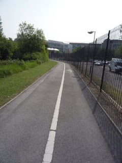
Well, that's interesting Here is another bit of the same path. You see it? Give way signs on either approach to the path. Therefore , despite the 50cm dropoff on one side and the ending on a kerb on the other, makes it the best cycle path in the whole of S Gloucestershire.

Compare to the path at the MoD roundabout. On a bicycle, you have to swerve right, sprint over a gap in traffic and get to the island -then repeat.
There is a sign warning cars of bicycles, but that's not a "give way", more a "look out, you may get some damage" warning, like a pothole warning sign.

That's on a roundabout where cars come off the A4174
Commuters come down from Gloucester, Swindon, even further away, at motorway speeds, then will have been doing dual carriageway speeds all the way until they get here. And what does the council put in for cyclist safety on a cycling city route? A warning sign. Not a stop, sign, not a give way sign, just a warning sign.

Frank, if you can fix up the dropoff so the whole Redrow route works, you've got our recommendation as replacing the entire cycling team in S Gloucs council, though someone will need to deal with Bwian Allinson and colleagues first.

Friday, 24 June 2011

Old Filton Road: this is what they give us

Old Filton Road is the road where cycling city money was wasted putting in a cycle lane "hint" on one side of the road, and a shit cycle/walk path on the other, purely so that the road could be re-opened as a rat-run, something the councillors were proud to take credit for. This is how South Gloucester council spent their part of the cycling city money, improvements which they say were "designed to improve the environment for cyclists and pedestrians". Exactly how turning a dead end road into a through route while giving a shit bit of pavement to the side for the walkers and cyclists to bicker over escapes us.


Before:
  1. A closed road with room for people to cycle in either direction on safely.
  2. No pavement, but no need to worry about rat-running cars.
  3. Room for pedestrians and lots of lunchtime runners.
After
  1. A road that cars can sprint along to avoid the traffic jam that is the A4174. Yes, it's left turn only at the end, but that gets you to UWE and the science park.
  2. A pavement that hasn't had any gardening budget spent on it since it was installed.
  3. Traffic calming in the form of some signs and one of those 30mph signs that lights up to remind people who were unintentionally -as opposed to knowingly- breaking the speed limit.

Say what you like about Bristol City Council, it didn't add something this awful and then stand up and be proud of it. Admittedly, S Gloucs council didn't either, not to the cyclists -they sold the entire scheme as "a road re-opens", with a sob story of how "drivers who had used the route were forced on to the already congested ring road instead.", missing the point that it was people choosing to drive were the problem, not the victims.

Some people are unhappy that not everyone cycles along this newly designated path. If the UKIP -the official party of the Association of British Drivers- got their way, it would be mandatory to cycle along the path.
That's the path that is getting slowly overgrown after two years of utter neglect; the trees overhanging the path while the vegetation curves back in. Of course anyone in their right mind would cycle on the road, such as the person vanishing into the distance.
Which raises the question: what was the fucking point in spending all this money on "cycle safety" in the first place. If you are going to build something so awful that nobody will use it, then neglect it utterly, it isn't worth bothering about.
Note that to reduce the risk of head on collisions on a cycle path so shite nobody uses it, there is a big sign on the west end of the path saying "No cycles". That just about sums it up for the entire S Gloucs council cycling plans: No cycles.

Given that the bollards are missing, this photo is probably going to become the official site logo.

Cherishing the leftovers

One of the weird things about the S Gloucs cycle paths is that they keep on trying to put in traffic calming and road signs into  them, instead of making the paths wider, and without understanding how people cycle.

Here's a bit of the ring road cycle path, near the Bridge Inn pub. You can see some fading signs which tried to split the cycle path in two with formal give way markings between them.

Fortunately, at some point in the last decade, they've been left to fade -perhaps somebody realised how useless they were. But they are there, if you look
If you look at the width the markings give you, there's just over two handlebar widths in the cyclists' part of the cycling|walking lane. It's better than the newer path on Old Filton Road, but you'd still need to not be pulling a cycle trailer, not doing a family ride with wobbly kids or encountering such oncoming traffic if you really had to share that half of the tarmac with oncoming bicycles.
The reality is, most people on a bicycle take up the whole of one of the lanes. If this was official, and there was a parallel walking route "a pavement" alongside, this would actually work and could be held up as good route.

The only reason there is no conflict here is that it is in the middle of fucking nowhere and nobody walks, even people on a bicycle aren't made to feel welcome, what with the lack of lighting. 

But no, there's no money to create a path wide enough for two lanes of cycles and pedestrians, to add lighting -everyone on foot or bike is left scrabbling for the leftovers.

What leftovers? This. The A4174 Emerson Green to the A4 link
Before this was built, the Bristol-Bath railway path -which the existing path connects up with -without a single gate or road crossing- ran up here to Pucklechurch along a lovely quiet path. But then the road planners said "Oh look, we could link up the North Fringe with Bath" and built a four lane near-motorway that only the very brave would cycle. At least we did get somewhere to walk and cycle, but
  • Why is it so narrow compared to the space dedicated to motor vehicles?
  • Why isn't it lit at night? The road is, until midnight. Are we somehow undeserving of street lights? You could argue that people on bicycles should have lights, but what about the pedestrians? 
  • Who is in the council thinks that painting give way and lane markings in cycle lanes too narrow for two bicycles makes sense? 
The whole path works, but it could be so much better. When you get to the Railway Path, you see people walking and cycling, it's lit at night, it's busy. Here? You see some people, between the vegetation growing in that nobody maintains, walking or cycling. No families out for a walk or cycle. Nobody caring about a boringly utilitarian path that has the background noise of any four-lane highway to deal with.

Welcome to South Gloucestershire: the council that doesn't really care for people on foot or bicycle

The Cycling Front claims victory in the Battle of the Bollards


Comrades! Citizens of South Gloucestershire! We have been quiet recently, but today have decided to confirm that it was our actions -along with someone making the national press from crashing into them- that caused the bollards of death to removed from the path West of Abbey Wood.


It was only after our direct action (and possibly the threat of more injury lawsuits) that the council acted to remove the bollards they had put in to try and keep people walking and cycling separate.

It is now possible for two bicycles to pass one another, albeit by having one of the bicycles swerve into the "pedestrian" side.
It is now possible to cycle along the path at night without hitting bollards which had to wait for direct action by the People's Cycling Front before they were visible at night.
However, the fundamental problem remains: the path is too narrow for people walking from the station to work or college and bidirectional cycling traffic. It may seem quiet here, mid-morning, but before 9:00 it is busy with people walking to work -often after haven gotten off the train, others cycling to work and schoolchildren. It's not just that the path isn't wide enough for the current load of bicycle and pedestrians at this time of day -it's not even wide enough for the current number of pedestrians.
Which raises a fundamental question: what were their traffic plans for the concorde way going to be? If there was going to be an increase in cycling, then an increase in conflict was inevitable -and the solution would be to widen the path. Not bollards: path widening.

This is the fundamental issue here: the walkers and cyclists are left scrabbling for leftovers while the council's main traffic "investments" go into road widening.